People, Places & Miscellaneous
The chapel was situated just south of Denhall Quay. It was opened to serve the colliery community but closed by 1926 when a new chapel was built in Bushell Road.
In the foreground is Tom Ashbrook of Colliery Farm. In the background can just be seen the bridge which was installed by Neston Colliery Co. at the bottom of Colliery Lane (Marshlands Road today) in about 1877. It carried the railway over the road; a WCC (Wirral Colliery Co.) wagon can be seen on the bridge.
Undated image, around 1900, of William Lawton, a Dee wildfowler who had a house on the quay. Silting means that much less of the stonework is visible today. The quay was built for Ness Colliery in about 1790.
Local men, women and children would scavenge for usable bits of coal amongst the waste from the colliery. The tip was named after Joe’ Muddy’ Jones, a colliery labourer who was said to have piled most of it. The image is probably dated around 1916. A woman picker collapsed and died while being chased by police from a tip in 1902.
The terraced houses were built in the 1870s for workers at the new Neston Colliery. The 21 houses of Seaview Cottages and Goldings’ Cottages are on the left; the 18 Smith’s Cottages are on the right.
The picture appears to show John and Mary Wragg who were the publicans in the 1880s, as well as a serving woman (possibly a Mary Curtis). Mary Wragg died in 1885 making this a very early image. It seems that Seven Row had not yet been built.
With thanks to Susan Chambers.
The licensee, John Palfreyman, stands outside his inn which was labelled ‘old’ even then. The building was there no later than 1778; the first record of it being a public house is in 1813 but it may well have been one long before then, serving the collier community. The houses of Seven Row are visible in the background to the right.
Lime kilns were built before 1871 in what is now the garden of Rose Cottage, the house to the rear of the Harp Inn. Limestone was burnt in the kilns to make a powder used as an agricultural fertiliser and to make mortar.
Almost certainly built for the Anglican, Smelting, Reduction and Coal Company Ltd. in about 1860 and later used by Neston Colliery.
Ellis Roberts was injured at the colliery in the 1870s. His leg was amputated and new one made by the colliery carpenter. Ellis had a number of subsequent jobs including being a railway watchman. His son, Robert, was killed at the colliery in 1917. Also shown (L-R standing): Daniel Brown (also in ‘Winding engine’ image above), Peter (?) Roberts, ‘Little Harry’ Jones; (sitting) Bertie (?) Oxton.
The map was made shortly before Neston Colliery opened on the site of the ‘Smelting Works (Disused)’. The works belonged to the Anglican Smelting, Reduction and Coal Co. Ltd. which went out of business in 1862. Ness Colliery (which closed in 1855) had operated from the area marked ‘Denhall Colliery (Disused)’.
Wirral Colliery was well developed by this time with two ‘Shafts’ marked (there were actually three) and the railway line coming into sidings from the north. The houses of New street and Seven Row have also been built.
Probably the most noticeable change from the 1899 map is the increased size of the spoil heaps; these would continue to grow until the colliery closed in 1927.
The certificate is for 20 shares issued to a Samuel Stitt in 1879. Stitt was an ex-army major and member of the Stock Exchange.
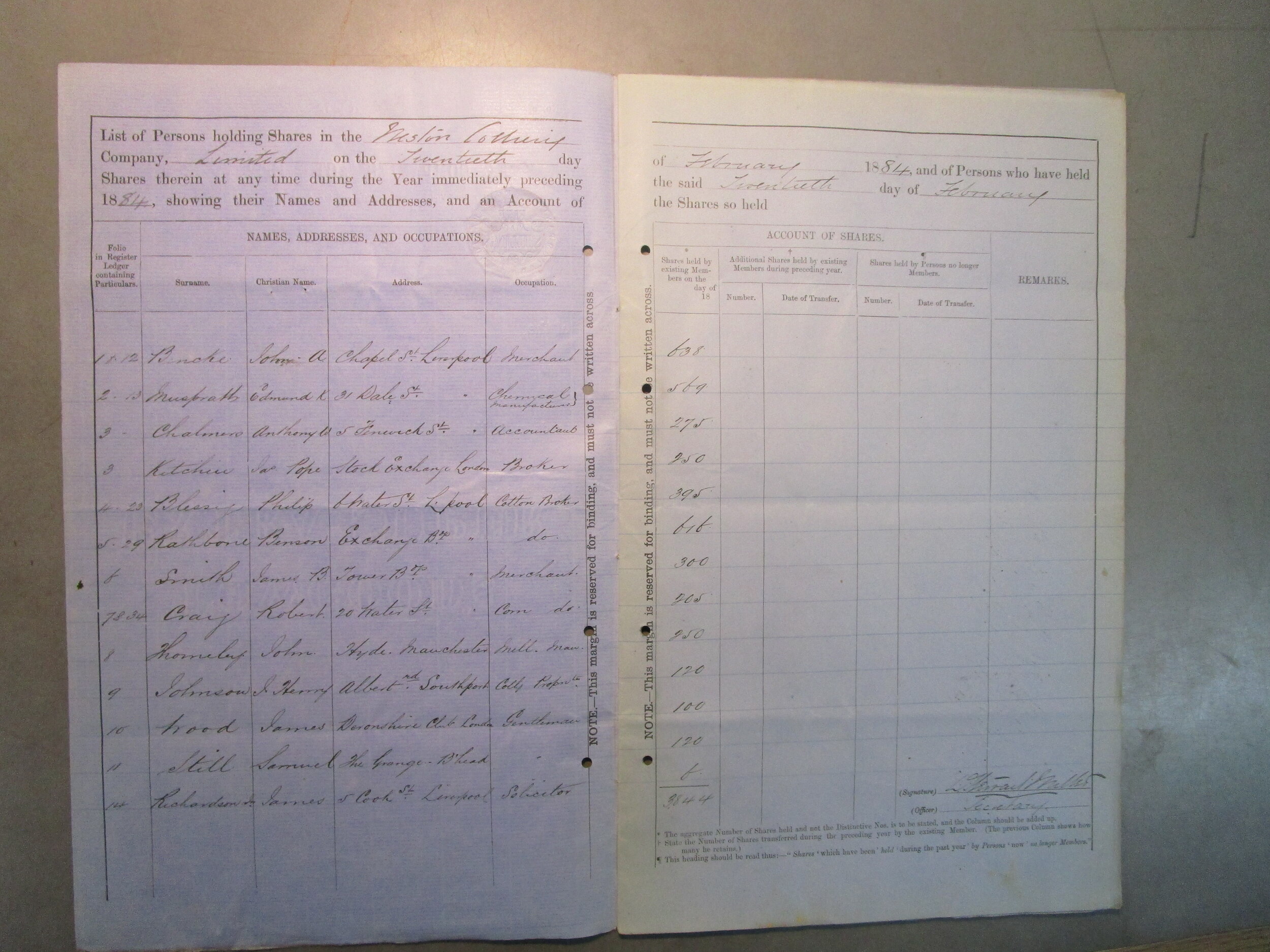
Samuel Stitt is listed amongst the shareholders (as ‘Still’) holding a total of 120 shares.
An invoice headed ‘Bought of the Wirral Colliery Co. Ltd.’ made out to the trustees of R[ichar]d Ashworth who had had a cotton manufacturing firm at Rawtenstall, Lancs. It shows the colliery was loaning equipment and manufacturing small iron items. There is also reference to boring work at New Farm, Hinderton near Neston.


